Hiking in the Fraser Valley, BC
If you find yourself in the Fraser Valley this summer I definitely recommend checking out a few of our local trails.
Abbotsford and Mission are often overlooked when people think of hiking destinations in the lower mainland but there are so many great trails to explore! There is a ton of variety depending on what you’re looking for; from family-friendly lake walks and waterfalls to longer treks to more remote lakes and look-outs, plus two amazing grinds for your regular workouts!
Mission Trails:
Devils Lake Loop:
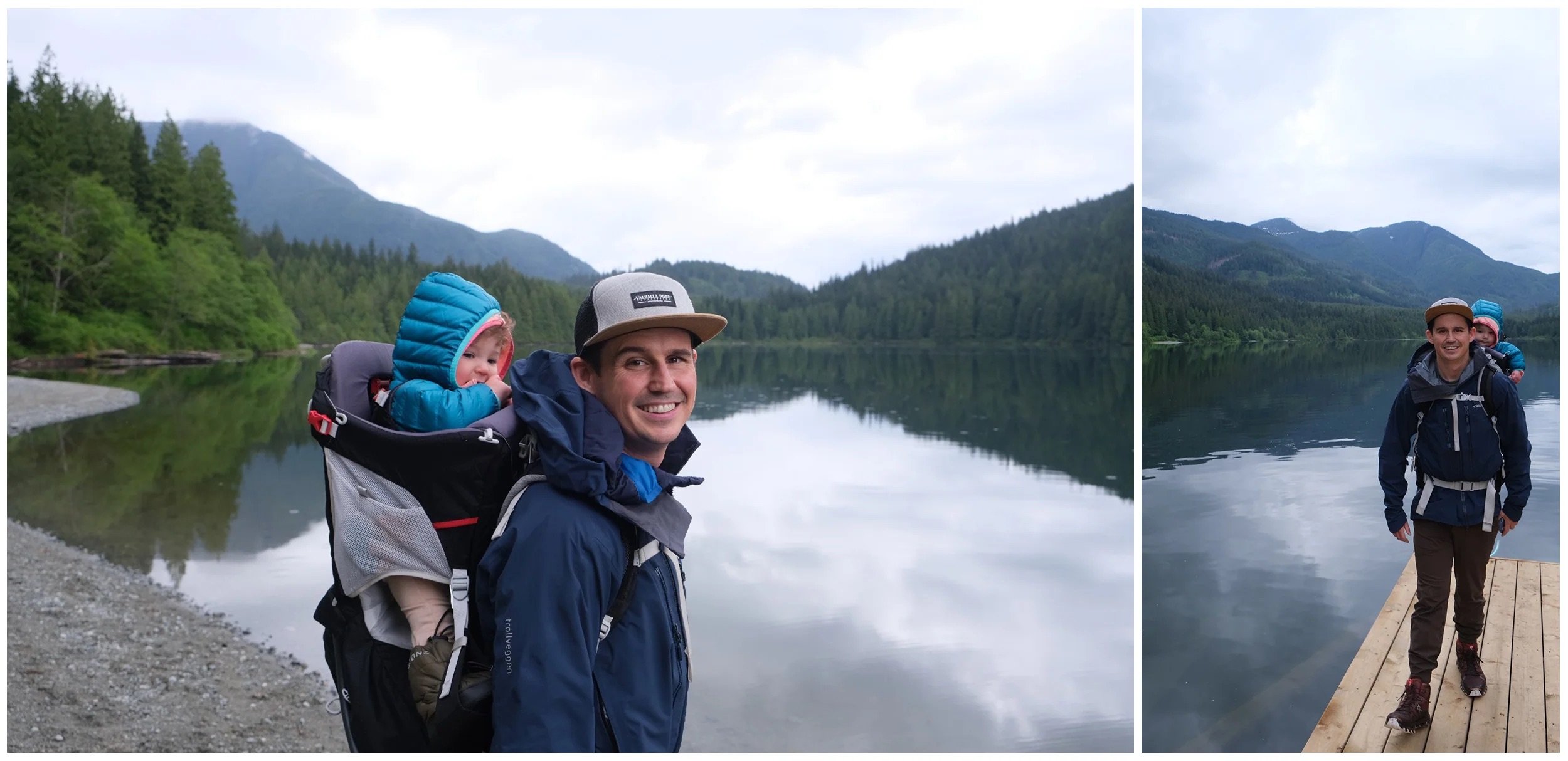
One of Mission’s newest trails is Devil’s Lake Loop; this trail starts on Florence Lake FSR and descends down to the lakeshore, meandering through the forest as it wraps around the lake and across a new floating bridge on the South End. The forest is very scenic with beautiful large trees and multiple bridges for small creek crossings.
The trail had a few ups and downs and could be slippery and muddy when wet but overall was family friendly and enjoyable, even in the rain.
Distance: 5km roundtrip
Elevation Gain: >100m
Type: Loop
Difficulty: Easy Hike
Access: Gravel Road - 2WD
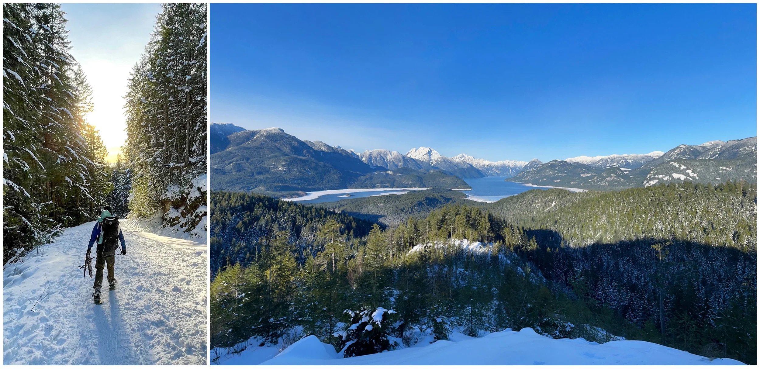
Another new trail; this route replaces the old logging route to Rolley Peak. The city recently installed a new viewing platform at the top with views of Stave and Devils Lake.
The trail to the platform is steep and rugged, quickly ascending through the forest to the platform with a few switchbacks. It is a great workout and the views from the top definitely make it worthwhile. In the rain or snow be prepared with spikes and poles.
Distance: 5km roundtrip
Elevation Gain: 550m
Type: Out and Back
Difficulty: Difficult to Moderate Hike
Location: Mission
Access: Gravel Road - 2WD
Hunter trail follows an old logging road for just under 4KMs to a lookout directly across from Rolley Lookout on the east side of Stave Lake. This trail is a steady but manageable climb and great for hiking or snowshoeing, the mountains at the north end of Stave Lake look stunning with a fresh dusting of snow.
Distance: 7.8km roundtrip
Elevation Gain: 325m
Type: Out and Back
Difficulty: Moderate Hike
Access: Paved Road
Insider Tip: There are two lookouts at the top and some smaller trails to explore. We managed to find an alternate trail to the trailhead descending steeply through the forest after a viewpoint of Hoover Lake. Check out GAIA GPS or FatMaps for more routes.
Cascade Falls:
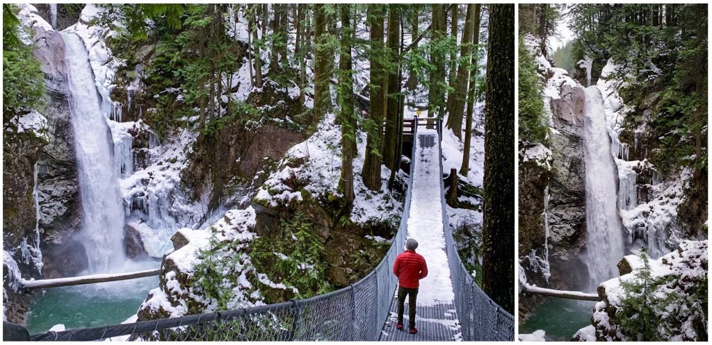
This trail is a quick climb up to beautiful falls and a very photogenic suspension bridge. The trail is well maintained and has a few sets of stairs with railings. The park can get very busy at peak times so plan accordingly. The river shore at the bottom is also beautiful for relaxing on a hot afternoon.
Distance: 0.6 km roundtrip
Elevation Gain: 27m
Type: Out and Back
Difficulty: Easy Hike
Location: Mission
Access: Paved Road
Insider tip: The falls are very photogenic in all conditions, if you want to enjoy them at a quieter time try checking them out in the rain or snow!
Bonus: Sayres Lake:
Sayres lake in NOT a hike, but a beautiful recreation site a few KMs up the road from Devil’s Lake and Grind. If you’re in the area, extend your drive and check out the dock out on the water, or pack your paddle board and head out for a multi-sport adventure!
Abbotsford Trails:
Chadsey Lake and Sumas Mountain Eastern Lookout (Baker Rock)
There are multiple trails to Chadsey Lake and Eastern Lookout however, the two main ones are:
From Sumas Mountain Road:
This trail is longer, starting outside Sumas Mountain Park. This trail is 2WD accessible and can be accessed at any time as opposed to the other trail which is only open during park hours and requires AWD /4WD access with some clearance.
This trail ascends through the forest up to Chadsey lake before wrapping around the lake to Eastern Lookout.
Distance: 16.9km roundtrip
Elevation Gain: 968m
Type: Out and Back
Difficulty: Hard Hike
Location: Abbotsford
Access: Gravel Road - 2WD
Insider tip: When you first reach the lake, many people head straight out to the lakeshore, continue along next to the lake on route to the Eastern Lookout and you will come to another beach with this fallen tree (think 2nd Joffree Lake) and this rope swing! In the summer the lake is actually a great temperature for swimming due to its smaller size and lower elevation.
From Sumas Mountain Lower Parking Lot:
The second option cuts off nearly half your distance and elevation, you’ll take the logging road up Sumas Mountain to the parking lot near the end of the public road. This actually puts you at a higher elevation than the lake meaning you will descend down to the main trail before heading to the lake. Once you descend to the main traip you will follow the same route as above to the lake and Eastern Lookout.
Distance: 9km roundtrip
Elevation Gain: 530m
Type: Out and Back
Difficulty: Moderate Hike
Location: Abbotsford
Access: Gravel Road - AWD or 4WD with clearance
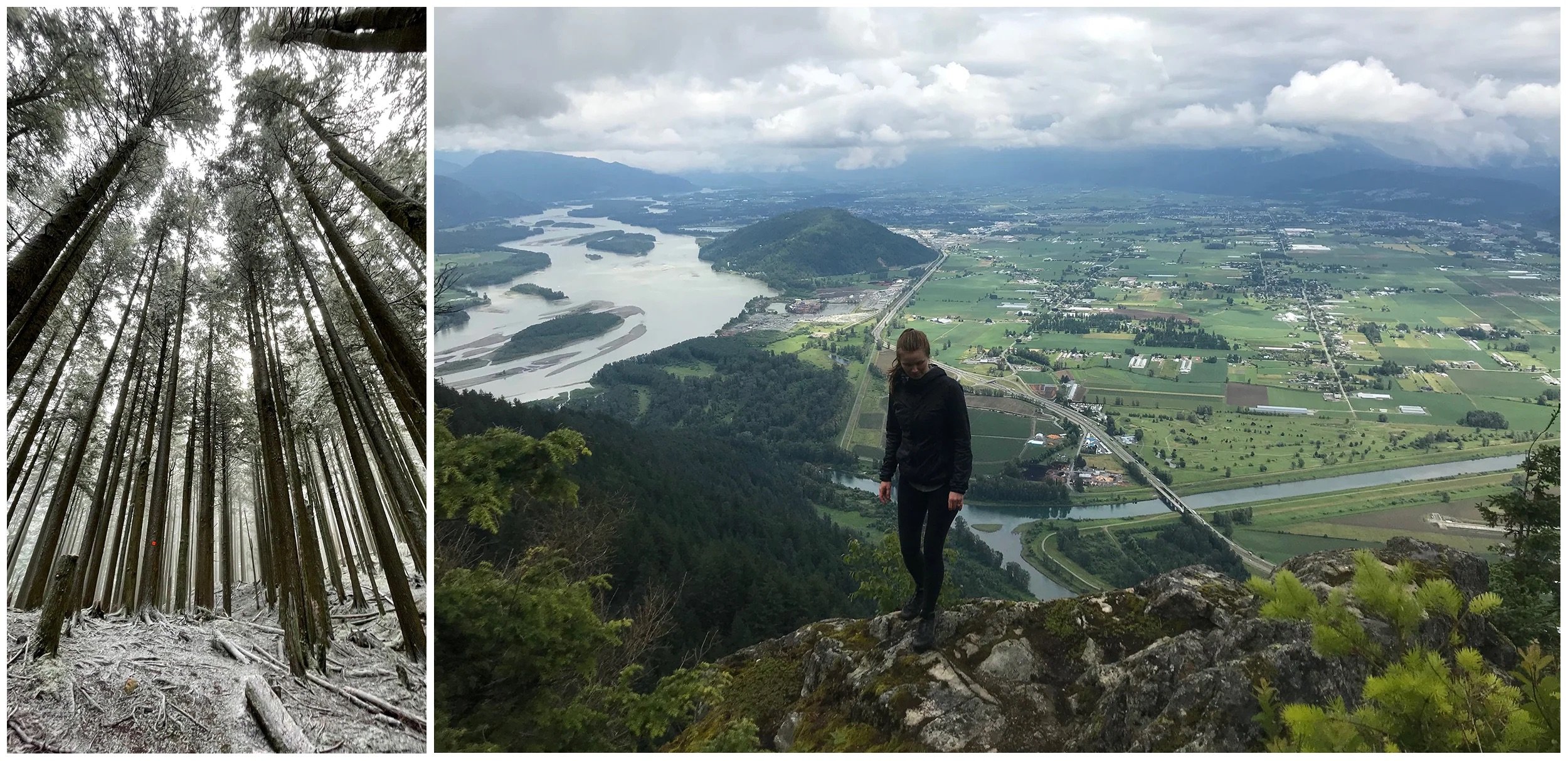
Insider tip: As you approach Eastern Lookout the obvious route is straight ahead as you start seeing views, about 50m back from this lookout look for a trail to the left, follow this trail to Baker Rock for a more expansive view of the valley below. From the lookout you will be able to see the Fraser River, Sumas Prairie, Chilliwack, Mount Woodside and on a clear day, the Cheam Range and Mount Baker.
An Abbotsford Classic! The Abby grind is a steep and quick trail up the South East side of Taggart Peak. The trail is a steady climb with a few switchbacks, and two viewpoints. The first view comes before the 1km mark just before the steep hill and the ½ way point. This view looks out over Sumas Prairie across to the Cheam Range. If you continue to the top you will reach the view shown above which opens up in both directions making it an excellent option for sunset!
Distance: 3.5km roundtrip
Elevation Gain: 435m
Type: Out and Back
Difficulty: Moderate Hike
Location: Abbotsford
Access: Paved Road
Insider tip: There are a number of new trails that have popped up in the last few months connecting back to the main trail. Bring a GPS and mapping tool and check them out!
You can also continue past the Abby Grind lookout to Taggart Peak. Trail is overgrown and has limited views once you reach the radio tower, if you’re looking for an extra workout, maybe just do the grind again.
McKee Peak:
McKee peak has an expansive network of trails for mountain biking, trail running, hiking and exploring. If you’re new to the area you can park on McKee road and walk up the main route on the gravel road to the top. This trail, while slightly longer than the Abby Grind, is less steep. Walking up the road will also limit the number of mountain bikers you will cross on the trail. Once at the top you can cross the field to find a concrete bench or this rope swing. With a western view, this trail is another great spot to catch the sunset.
Distance: 5.6km roundtrip
Elevation Gain: 260m
Type: Out and Back
Difficulty: Moderate Hike
Location: Abbotsford
Access: Paved Road
Insider tip: There are tons of amazing spots to check out on McKee peak, including waterfalls, rope swings, caves and more. Use AllTrails or bike specific apps like TrailForks to navigate the trail network up there.
Gear:
I’ve put together a Day Hiking Checklist with a complete list of gear recommendations.
And as always, here’s a few reminders for recreating responsibly from the Parks Canada team and Leave No Trace Canada:
Rules for exploring our beautiful backyard:
Plan and prepare:
Plan your travel route
Know the terrain and conditions
Check the weather
Fill out a trip plan (check out AdventureSmart for more information)
Be considerate of other visitors:
On narrow trails, give way to uphill hikers.
Take breaks on durable surfaces off the trail.
Give freedom for the sounds of nature. Avoid excessive noise.
Pack out what you pack in, and help clean up the trails on your adventures.
And most importantly, have fun!
Disclaimer: This blog post may feature some affiliate links, which means I get a small commission if you make a purchase (at no extra cost to you). It’s one of the ways I can keep producing free guides and resources for my readers. Thank you for the support!


