Hiking Cheam Peak: A Guide to Conquering One of Chilliwack’s Most Iconic Summits
Nestled in the heart of the Chilliwack River Valley, Cheam Peak stands as one of the most recognizable and rewarding hikes in the Lower Mainland. With its sweeping views of the Fraser Valley, surrounding mountain ranges, and the iconic Spoon Lake, Cheam Peak is a must-do for any avid hiker. However, this hike is not for the faint of heart—it requires preparation, stamina, and a sense of adventure.
In this blog, we’ll cover everything you need to know about hiking Cheam Peak, including its history, trail details, photography tips, and how to prepare for this epic adventure.

Cheam Peak Trail, Chilliwack BC
The History of Cheam Peak
The name “Cheam” (pronounced “chee-am”) is derived from the Halq’eméylem word meaning “wild strawberry place.” The mountain holds cultural significance for the Stó:l ō First Nation, who have lived in the region for thousands of years. The Cheam Range, which includes peaks like Lady Peak, Foley Peak, and Baby Munday, is part of the larger Skagit Range of the Cascade Mountains.
The area also has a rich mountaineering history. In the early 20th century, legendary climbers like John Clarke and Don and Phyllis Munday explored and mapped much of the region. Some hikers still attempt the challenging Archibald Route, which starts from the highway and was one of the original paths used by early climbers. However, this route is steep, rugged, and only recommended for experienced adventurers.
Cheam Peak Trail, Chilliwack BC
Cheam Peak Trail, Chilliwack BC
Driving Directions and Road Conditions
Cheam Peak is located in the Chilliwack River Valley, about 2 hours from Vancouver. Here’s the correct way to get there:
From Vancouver, take Highway 1 (Trans-Canada Highway) east toward Chilliwack.
Take Exit 104 for Vedder Road and turn left onto Vedder Road.
Follow Vedder Road as it becomes Chilliwack Lake Road. Continue on Chilliwack Lake Road for approximately 20 km.
Look for the turnoff to Chipmunk Creek Forest Service Road (FSR) on your left. This is a gravel road that leads to the trailhead.
Drive carefully up Chipmunk Creek FSR for about 12 km to the parking area.
Important Notes About the Road:
The Chipmunk Creek FSR is steep, narrow, and extremely rough. A high-clearance 4x4 vehicle is highly recommended—low-clearance vehicles will not make it.
The road is often riddled with potholes, loose rocks, and washouts. Drive slowly and cautiously.
There are a few creek crossings, so be prepared for water on the road, especially in spring or after heavy rain.
The road is not maintained regularly, so conditions can vary. Check recent trail reports or forums for updates before heading out.

Chipmunk Creek FSR, Chilliwack BC

Cheam Peak Trail, Chilliwack BC
Trail Stats and Details
Distance: 9.5 km round trip
Elevation Gain: 700 meters
Time Required: 5-7 hours
Difficulty: Moderate to difficult (due to steep sections and elevation gain)
The trail begins at the parking lot, where you’ll already be treated to stunning views of the Fraser Valley. The first section of the hike is a steady climb through subalpine meadows, which are particularly beautiful in late summer when the wildflowers are in bloom.
As you ascend, the trail becomes steeper and more rugged, with some rocky sections requiring careful footing. About halfway up, you’ll reach Spoon Lake, a small, picturesque alpine lake that’s perfect for a quick rest or photo op.
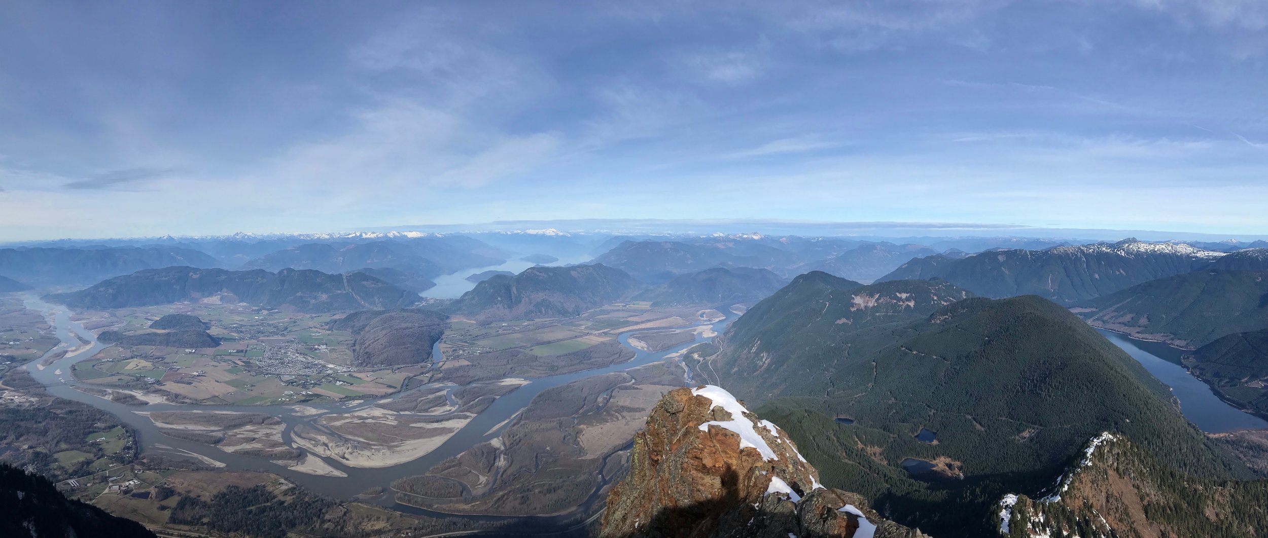
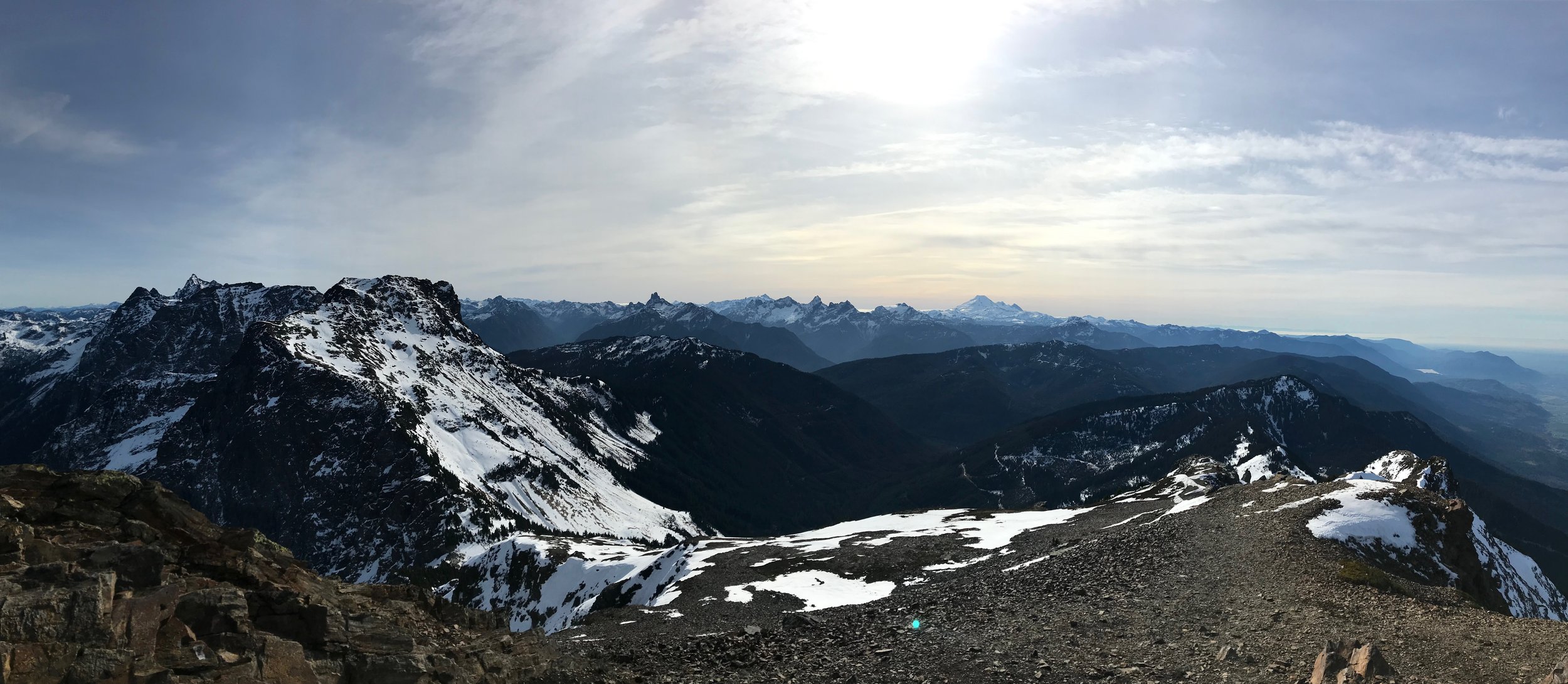
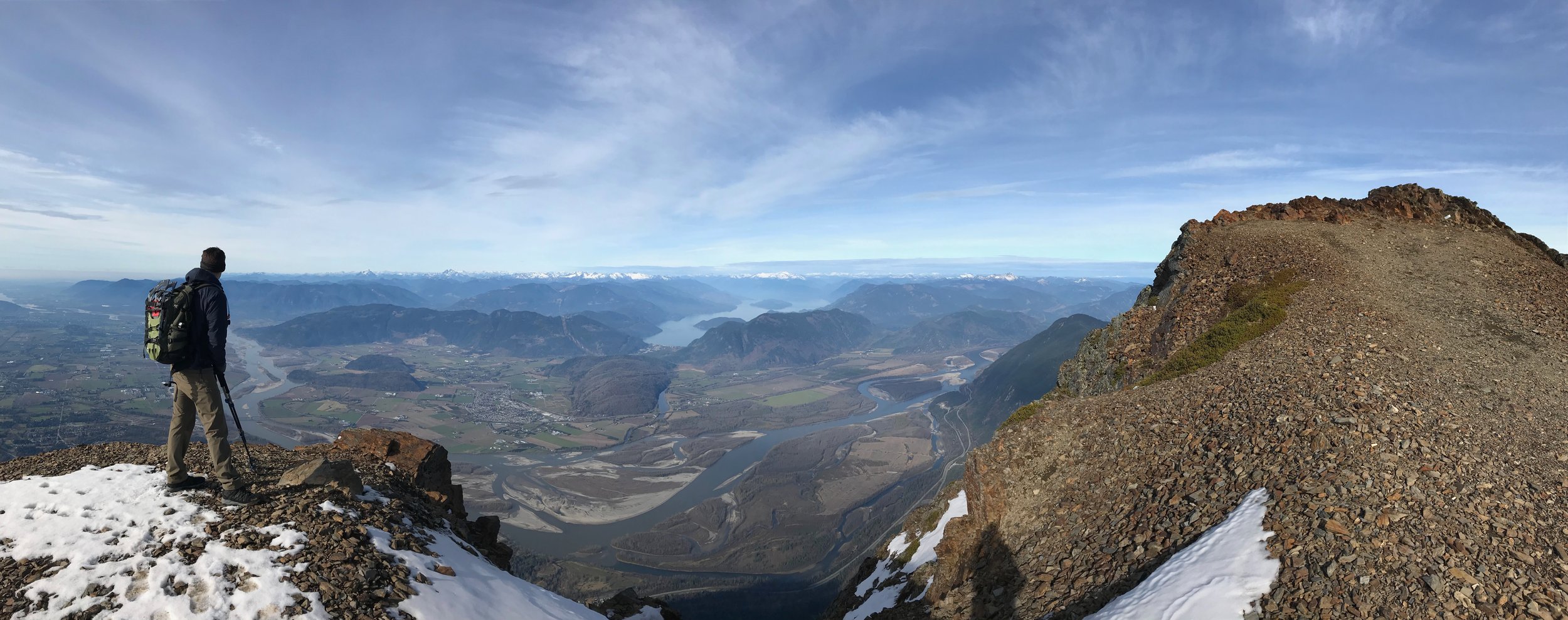
The final push to the summit involves a steep scramble over loose rocks. The effort is worth it—once you reach the top, you’ll be rewarded with 360-degree views of the Fraser Valley, Mount Baker, and the surrounding peaks of the Cheam Range.

Cheam Peak Trail, Chilliwack BC

Views from the summit, Cheam Peak Trail, Chilliwack BC
Photography Tips
Cheam Peak is a photographer’s dream. Here are some tips for capturing the best shots:
Golden Hour: Sunrise or sunset provides the best lighting for dramatic landscapes.
Wildflowers: Late July to early August is the best time to capture the vibrant alpine meadows.
Spoon Lake: Use the lake as a reflective foreground for stunning compositions.
Panoramic Views: Bring a wide-angle lens to capture the expansive views from the summit.
Weather: Clear days are ideal, but don’t shy away from moody clouds—they can add drama to your photos.

Views of Jones Lake from Cheam Peak Trail, Chilliwack BC
Training Hikes for Cheam Peak
If you’re new to hiking or want to build up your stamina, here are some recommended training hikes in the Lower Mainland:
Bridal Veil Falls (Chilliwack)
Distance: 1 km round trip
Elevation Gain: Minimal
Time Required: 30-45 minutes
Why It’s Great: This super short hike leads to a breathtaking waterfall. It’s perfect for beginners or those looking for a quick outdoor adventure. The trail is flat and well-maintained, making it accessible for all skill levels.
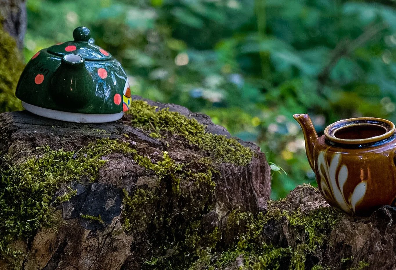
Teapot Hill (Cultus Lake)
Distance: 5 km round trip
Elevation Gain: 200 meters
Time Required: 1.5-2 hours
Why It’s Great: Located near Cultus Lake, this family-friendly hike is gentle and scenic. The trail winds through the forest, with occasional views of the lake. Plus, there’s a fun scavenger hunt for hidden teapots along the way!
Lindeman Lake (Chilliwack)
Distance: 3.4 km round trip
Elevation Gain: 300 meters
Time Required: 2-3 hours
Why It’s Great: This short but rewarding hike takes you to a stunning turquoise lake surrounded by forest and mountains. The trail is well-maintained, with some uphill sections that are perfect for building endurance.
Mount Thom Trail (Chilliwack)
Distance: 7 km round trip
Elevation Gain: 500 meters
Time Required: 4-5 hours
Why It’s Great: Mount Thom is a local favorite in Chilliwack, offering panoramic views of the Fraser Valley, Cultus Lake, and the surrounding mountains. The trail begins with a steady climb through the forest before opening up to a series of viewpoints. The summit features a large grassy area perfect for a picnic.
Tunnel Bluffs (Lions Bay)
Distance: 11 km round trip (via the Tunnel Point Route)
Elevation Gain: 500 meters
Time Required: 4-5 hours
Why It’s Great: Tunnel Bluffs is a popular hike that offers stunning views of Howe Sound, the Sea-to-Sky Highway, and the surrounding islands. The trail begins with a steep climb through the forest before levelling out and leading to the bluffs. The final viewpoint is a wide-open area with plenty of space to relax and take in the scenery.
These hikes will help you build the endurance and strength needed to tackle Cheam Peak.

Tunnel Bluffs, North Vancouver
Double Summit: Cheam Peak and Lady Peak
If you’re up for an extra challenge, consider adding Lady Peak to your hike. Lady Peak shares the same trailhead as Cheam Peak and offers equally stunning views. The trail splits about 2 km in, with Lady Peak being a more technical and exposed scramble.
For more details, check out my blog on hiking Lady Peak.

Views of Mount Baker from Lady Peak, Chilliwack BC
The 10 Essentials and Preparation
Before heading out, make sure you’re prepared with the 10 Essentials:
Navigation (map, compass, GPS)
Headlamp (with extra batteries)
Sun protection (sunglasses, sunscreen, hat)
First aid kit
Knife or multi-tool
Fire starter (lighter, matches)
Shelter (emergency bivy)
Extra food
Extra water (or a filtration system)
Extra clothing (layers for changing weather)
For a more detailed checklist, check out my Day Hiking Checklist Blog.
Cheam Peak Trail, Chilliwack BC
Hiking Cheam Peak is a challenging but incredibly rewarding experience. From its rich history to its breathtaking views, this hike is a true gem of the Chilliwack River Valley. Whether you’re a seasoned hiker or working your way up to more difficult trails, Cheam Peak is a summit worth striving for. So lace up your boots, pack your gear, and get ready to conquer one of British Columbia’s most iconic peaks!